Infrastructure As Landscape
- Semester: 2021-2022
- Project Type: Thesis
About this Project
Restoring and extending the existing urban fabric into the Inner Loop Highway in Rochester, New York provides access and reconnects historically isolated communities with a revitalized city center. The development of interstate highways in American cities has led to the disenfranchisement and economic decimation of minority communities. Urban highways were part of a larger program of targeted displacement and disconnection through redlining. As Rochester’s ring-road removal has already opened up new opportunities
for weaving the southeastern neighborhoods with a reviving downtown. This work explores new opportunities to build upon the city’s legacy as a
center for technological advancements, a hub of social activity, and satisfying a demand for people to live downtown. A human-scale city street for all
users will replace the highway over the Genesee River. There are new opportunities for development on land that was once inaccessible due to the infrastructure barriers. Proposed buildings can be utilized as multifunctional spaces that can hold mixed-use programs. New public space and water-
front amenities create a new center of activity for Rochester bringing people into direct connection with the Genesee River and its High Falls. These elements combined with holistic urban-scale development allow for a restoration of the city that catalyzes economic and social revitalization.
Software utilized:
Google Earth | Adobe Photoshop | Adobe Lightroom | Nano Banana

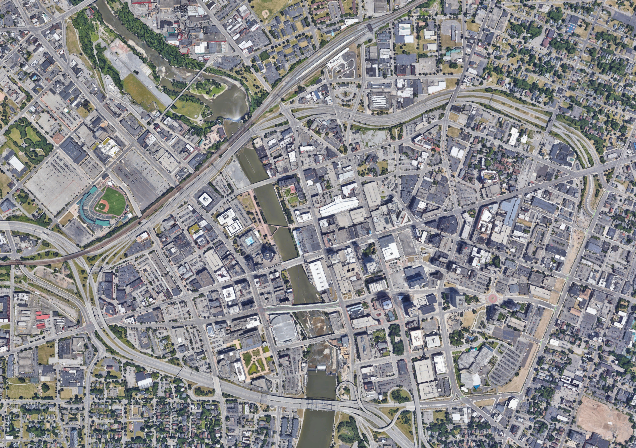
Existing Rochester, NY Aerial
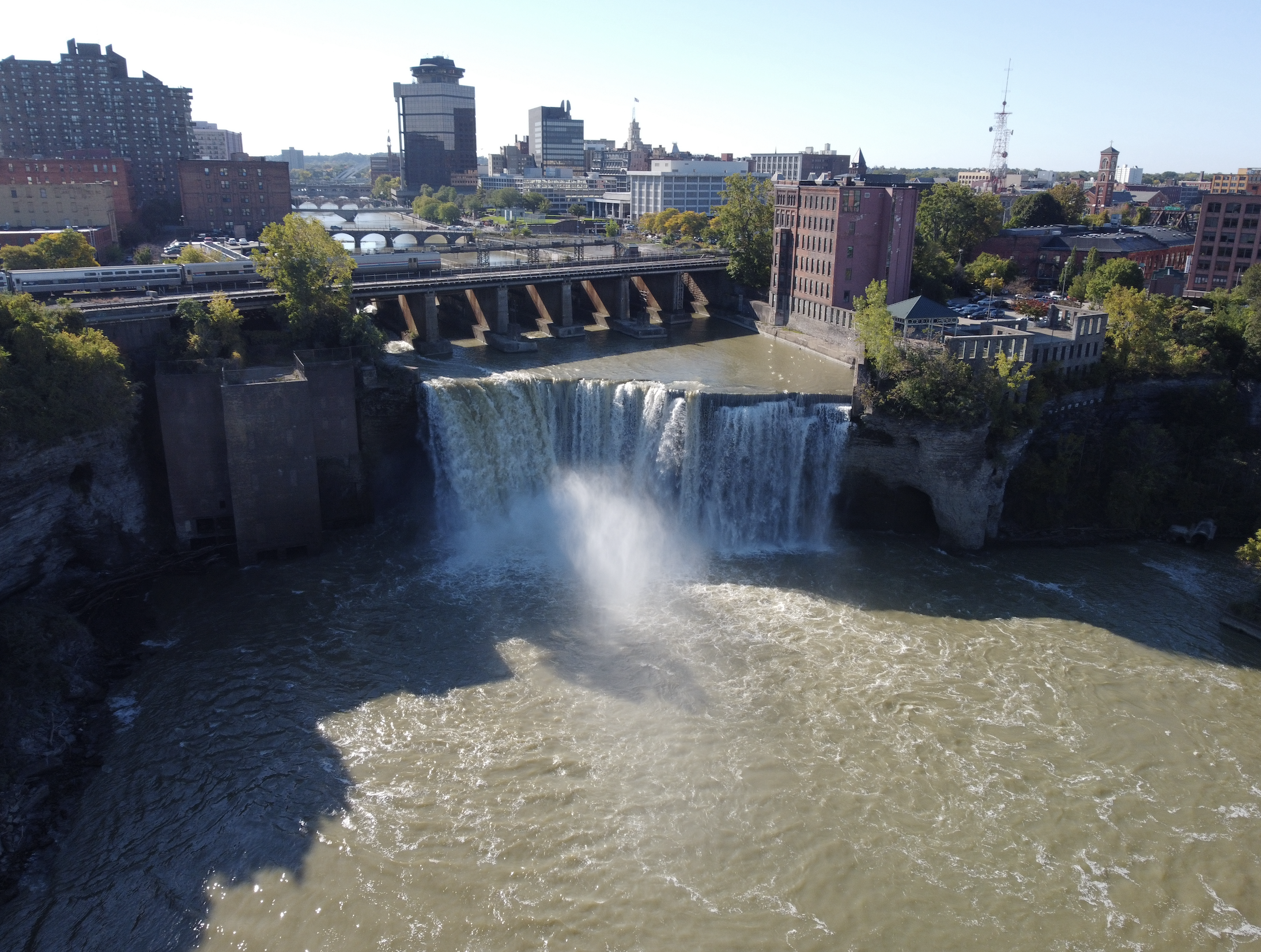
Existing High Falls
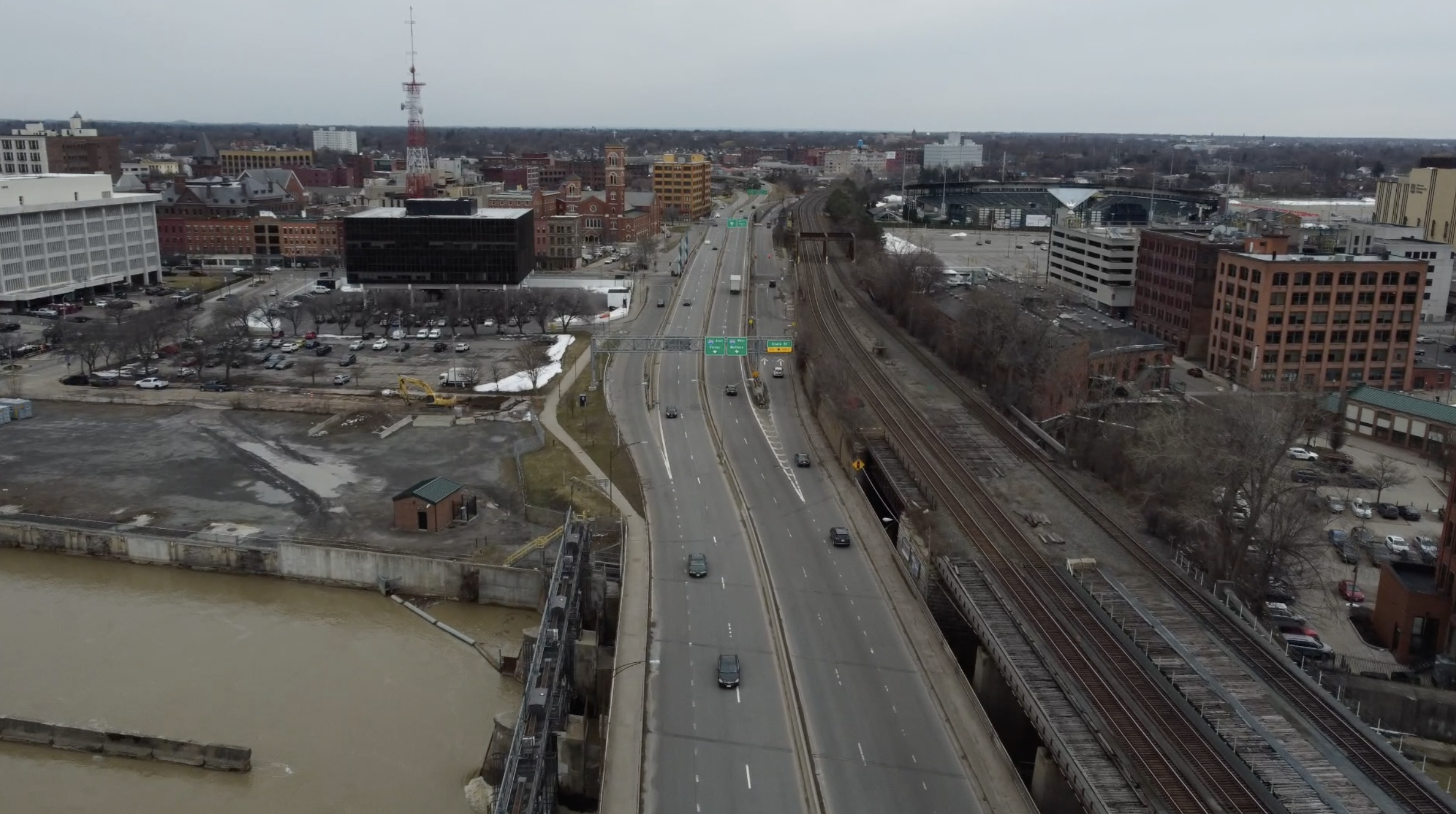
Existing Inner Loop Highway – Genesee River Intersection
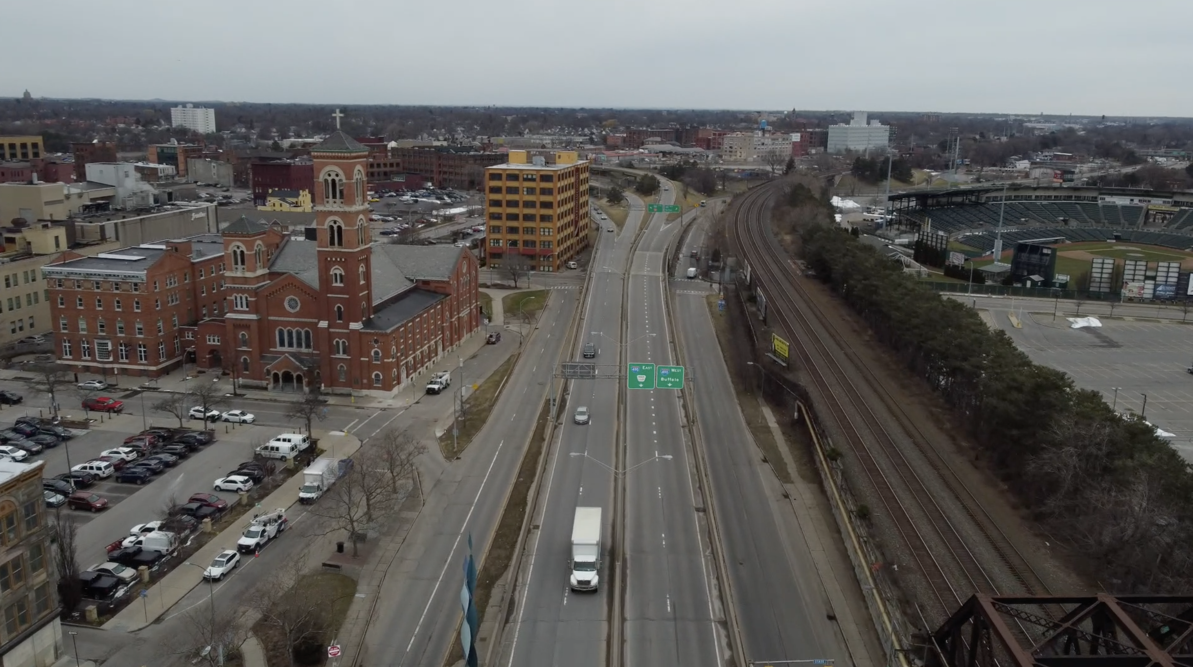
Existing Inner Loop Highway North


This master plan envisions the transformation of the Inner Loop North from a sunken barrier into a vibrant, multi-modal boulevard that re-knits Rochester’s urban fabric. By replacing the former expressway with a human-scaled street grid, the design unlocks approximately 22 acres of land for equitable development, healing the historic divide between Downtown and neighborhoods like Marketview Heights and High Falls.
-
Restoring the Grid & Urban Infill: The plan fills the existing highway to establish a flush, at-grade street network. This new foundation supports a dense corridor of 4-to-6-story mixed use buildings. The architecture prioritizes a timeless aesthetic, utilizing brick facades that honor Rochester’s industrial heritage while replacing vacant lots and graffiti tagged structures with high quality residential and commercial space.
-
Complete Streets & Multi-Modal Mobility: Moving beyond the car-centric design of the 1950s, the new main artery is designed as a Complete Street. The section creates a balanced hierarchy:
-
Central Mobility: Two distinct central lanes preserve efficient vehicle flow for essential traffic.
-
Active Transportation: The outer lanes—traditionally reserved for parking or moving traffic—have been reclaimed for dedicated bicycle infrastructure, ensuring safe, protected travel for cyclists.
-
Pedestrian Realm: Wide sidewalks lined with mature street trees create a shaded, walkable promenade that encourages foot traffic for ground-floor retail, such as local bakeries and cafes.
-
-
Infrastructure Integration: A defining feature of the plan is the seamless integration of the active railroad corridor. Rather than treating the rail line as a dead-end barrier, the design articulates a clear underpass strategy. The street grid continues fluidly beneath the elevated rail tracks, maintaining visual and physical connectivity to the eastern neighborhoods and ensuring the city remains permeable.
-
Green Connectivity: The streetscape serves as a linear park, with consistent tree planting acting as a green spine. This approach reduces the urban heat island effect and provides a soft visual buffer between the active roadway and the residential edges, contributing to the broader goal of creating new active and passive green spaces.


