Fernwood Apartments
- Rochester, New York
- 2025
About this Project
Fernwood Apartment units is a well-situated multifamily residential community in Rochester, New York, offering a mix of one and two bedroom apartments across 80 designed units. The community features two different units to provide flexibility to a broad tenant demographic. There are ADA units included on each floor level to ensure access for people with disabilities and the property provides comfortable, high-value living options for a diverse range of renters. Each unit is designed to provide functional living spaces that meet the everyday needs of residents, with layouts that optimize natural light and flow between living areas, bedrooms, kitchens, and bathrooms.
Role:
Architectural Designer / Draftsman
Tasks:
– Executed a comprehensive set of architectural drawings, including floor plans, wall sections, and intricate detailing to ensure design intent and constructability under the guidance of the Senior Project Manager
– Developed a rigorous code analysis to ensure the multi-family residential structure met all local zoning ordinances and building safety standards
– Developed a high-detail 3D model that served as the visualization output and the baseline for the technical drawing set.
Software Utilized:
Revit | Enscape| Photoshop | Nano Banana
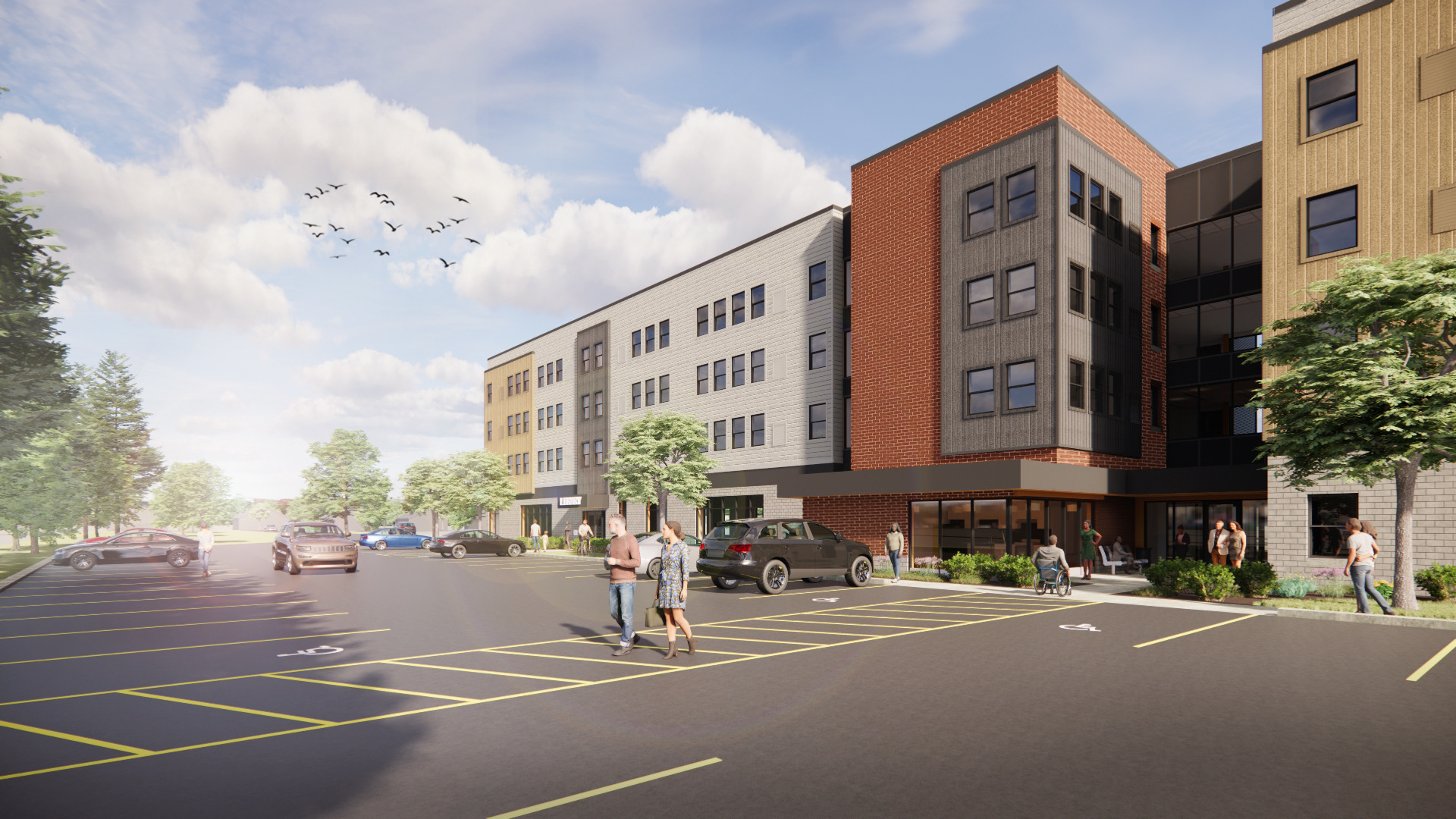

For the Fernwood Apartments, I leveraged AI-driven rendering to evolve the initial 3D model into high-fidelity visualizations. This workflow enables a precise exploration of natural light and tactical materialities such as wooden slats, brick, and concrete. This also allowed for a deeper exploration of refining the exterior urban fabric. This ensured further connection between the Architecture and surrounding public space.

This diagram illustrates the planned movement of vehicles and pedestrians throughout the site. It uses specific line types and colors to distinguish between different types of paths:
-
Vehicular Circulation: Red dashed lines with arrows show the flow of cars, indicating the primary routes for entering and exiting the parking lot and navigating around the building.
-
Pedestrian Circulation: Blue dashed lines with arrows depict the designated walkways for people, showing paths on sidewalks, across the plaza, and leading to building entrances.

This diagram analyzes the sun’s path and its impact on the building and site throughout the year. It typically shows:
-
Sun’s Path: Arcs with arrows indicate the position of the sun at different times of the day (e.g., 9 AM, Noon, 3 PM) for key dates like the summer and winter solstices.
-
Shadow Studies: The diagram includes shadows cast by the building at these times, helping to identify areas that will be in sun or shade. This information is crucial for designing the outdoor spaces and placing vegetation.

This diagram explains how rainwater is managed on the site to prevent flooding and protect water quality. It uses arrows and symbols to show:
-
Water Flow: The direction stormwater runs off impervious surfaces like rooftops and parking lots.
-
Green Infrastructure: The diagram also highlights sustainable stormwater management practices, such as permeable pavements and bioswales, which allow water to infiltrate into the ground, reducing runoff volume and filtering pollutants.


